I have a MGL EFIS. How do I customize the 'Flight Data Viewer' to match my installed EFIS?
Run the 'Flight Data Viewer' and from the menu select 'Options'.
Update your preferences as suggested below.
Data Folders
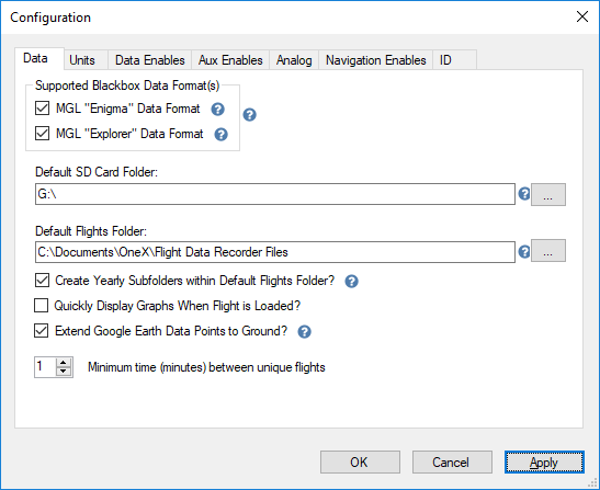 Notes:
If your MGL EFIS device creates the 'Engima.rec' file check the "MGL 'Enigma' Data Format" box.
If your MGL EFIS device creates the 'iEFIS.rec' file check the "MGL 'Explorer' Data Format" box. The newer iEFIS devices use this format.
If you are unsure check both.
Enter the drive where you will insert the SD card removed from your EFIS.
Enter the folder path where you would like to store your extracted flight data files. The default is appropriate for most situations.
If you check 'Create Yearly Subfolders ...' folders named with the flight year (ex: 2018) will be created and your flight files will be stored in the correct folder.
'Quickly Display Graphs When ...'. Turn this option on or off and load a saved flight to see the behavior controlled by the option.
'Extend Google Earth Data ...'. If checked a thin line will connect the flight path to the ground. The line makes altitude easier to visualize.
'Minimum time between ...' This option is only useful if the engine is turned off during the flight (motor gliders for example).
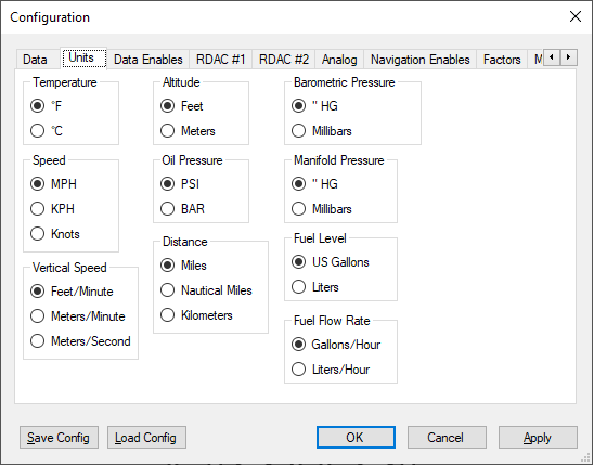
Units
Data / Equipment Enables
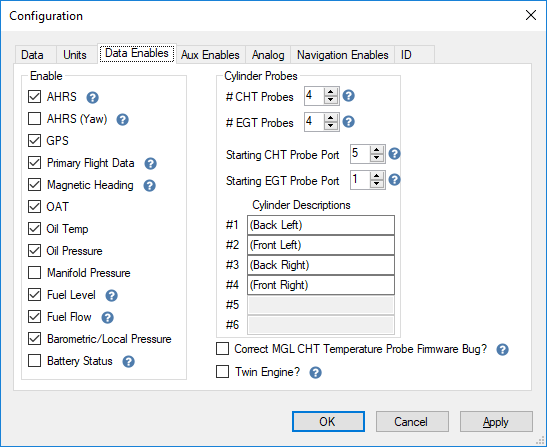 Notes:
The most important items on this tab are the
number of CHT & EGT probes and the
starting port numbers the probes are connected to on the RDAC.
The cylinder descriptions are displayed on the CHT & EGT graphs.
Check 'Twin Engine' if your aircraft has two engines. Requires two RDACs.
Check 'Correct MGL CHT Temperature Probe Firmware Bug?'
only if: 1) you are using a legacy device (Enigma, Voyager that uses the Enigma.rec recording file) and 2) you use type 'J' CHT temperature probes.
Auxiliary Equipment Enables
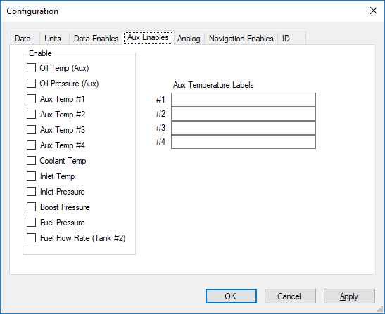 Notes:
 Most installations do not use these options.
Analog Data Port Configuration
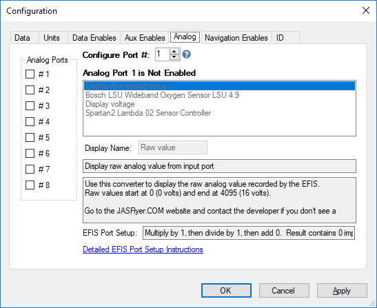 Notes:
There is a bug in the MGL software that causes random/invalid data to be stored for analog ports. The data displayed from analog ports is therefore unusable and should be ignored until MGL fixes this bug.
Most installations do not use these options. Analog data feeds are connected to one of the 8 analog/digital data ports on an iBox.
After enabling the port (by checking it) select the type of equipment connected to the port. If the equipment is not listed contact
and request a new data filter.
Current filters:
Bosch LSU Wideband Oxygen Sensor
Spartan2 Lambda Oxygen Sensor
Navigation Enables
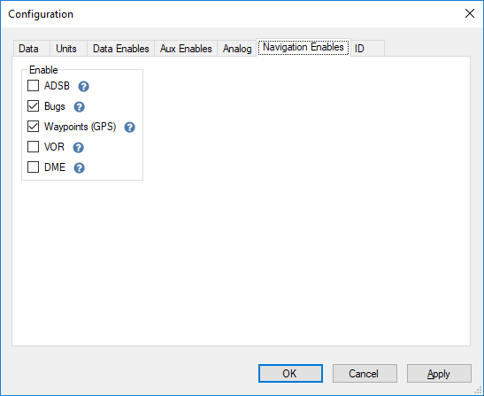 Notes:
ADSB currently does nothing. We are working with MGL to determine when ADSB traffic alerts will be recorded (only the newer iEFIS MGL devices.)
Enabling bugs will display the heading & altitude bugs set during the flight.
Miscellaneous
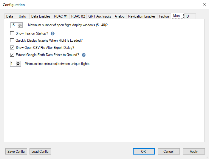 Notes:
'Quickly Display Graphs When ...'. Turn this option on or off and load a saved flight to see the behavior controlled by the option.
'Extend Google Earth Data ...'. If checked a thin line will connect the flight path to the ground. The line makes altitude easier to visualize.
'Minimum time between ...' This option is only useful if the engine is turned off during the flight (motor gliders for example).
Plane / Pilot [ ID ]
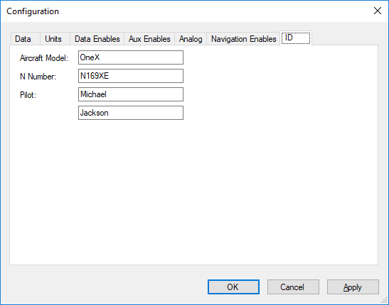 Notes:
These values are saved in each extracted flight file.